
C11 – On-demand land cover mapping
Creating a new on-demand land cover mapping service.
Domain
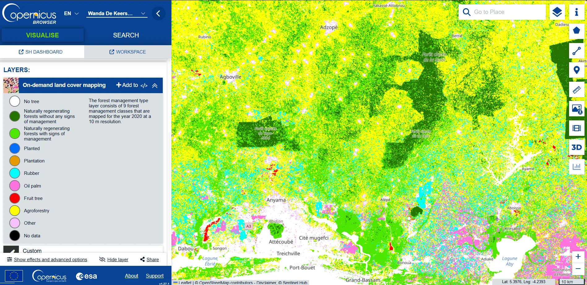
The wide range of LC products needed by users can best be met by processing systems able to accommodate user-defined tailoring via user-provided parameters – e.g., the number, types and definition of classes, AOI, temporal needs – and then generate on-demand the desired customised product. This candidate will demonstrate such an on-demand LC service by showcasing a number of tailored LC products with customised classes (e.g., crop types, leaf types, plantations) at different spatial resolutions (100m, 10m, 5m) and observation periods. This candidate will rely on developments in in-situ data, generic embeddings, improved resolution and novel infrastructure (on-demand).
Newsletter
Stay current! Subscribe to our EvoLand newsletter!