Mapping what matters: Cover crop typing for smarter soil management
31 Jul 2025
Why Cover Crops Matter for CLMS
Building on the existing Copernicus High-Resolution Layers on Vegetated Land Cover Characteristics (HRL-VLCC), the C4 prototype takes monitoring one step further. While the current layers capture broad crop seasonality (e.g., emergence or duration of secondary crop seasons), this new prototype digs deeper, identifying the specific cover crop types used across agricultural fields.
This level of detail brings direct added value to CLMS, especially as policies such as the EU Green Deal and the new Common Agricultural Policy (CAP) increasingly incentivise soil protection and biodiversity-enhancing farming practices.
The C4 workflow
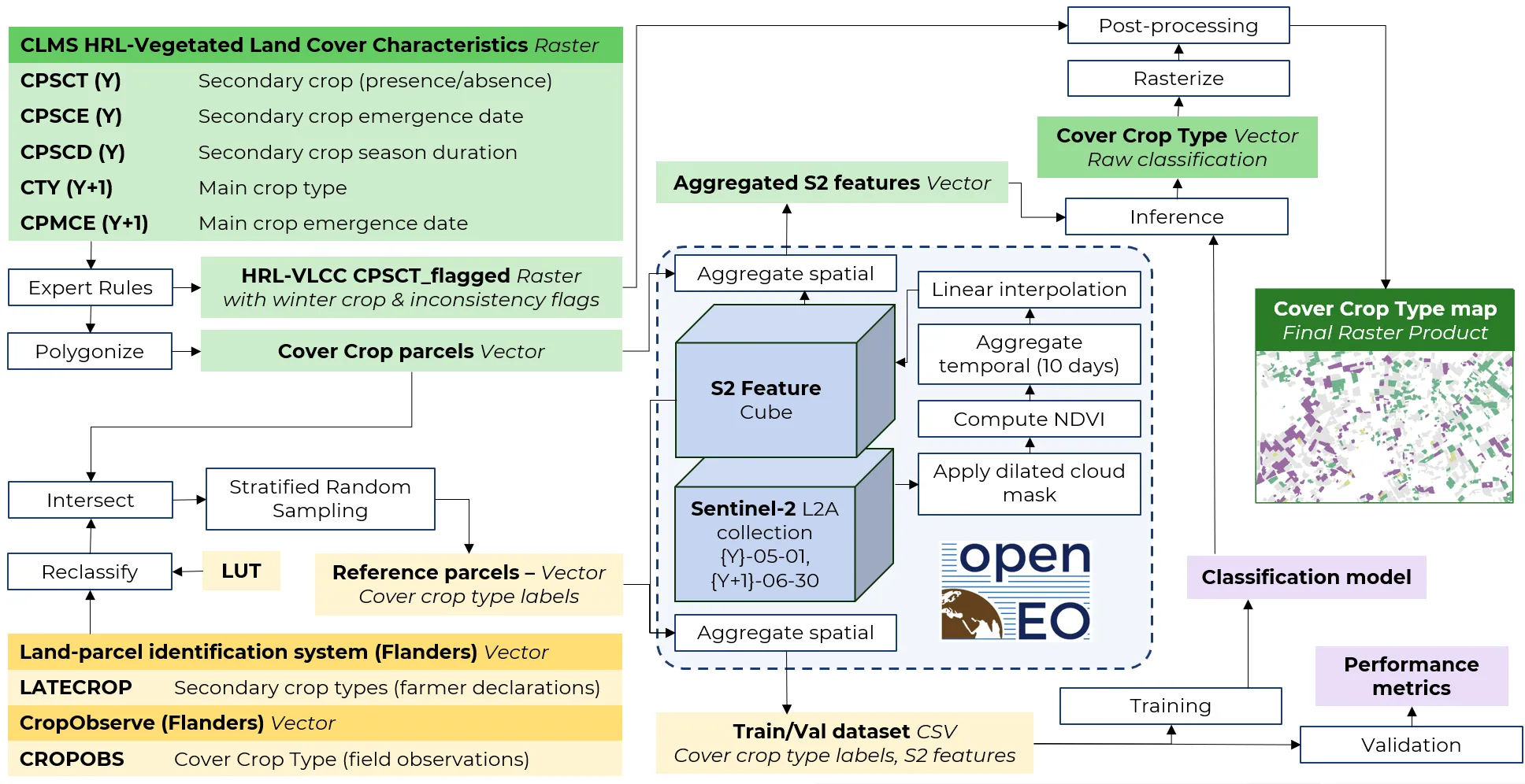
The Method Behind the Mapping
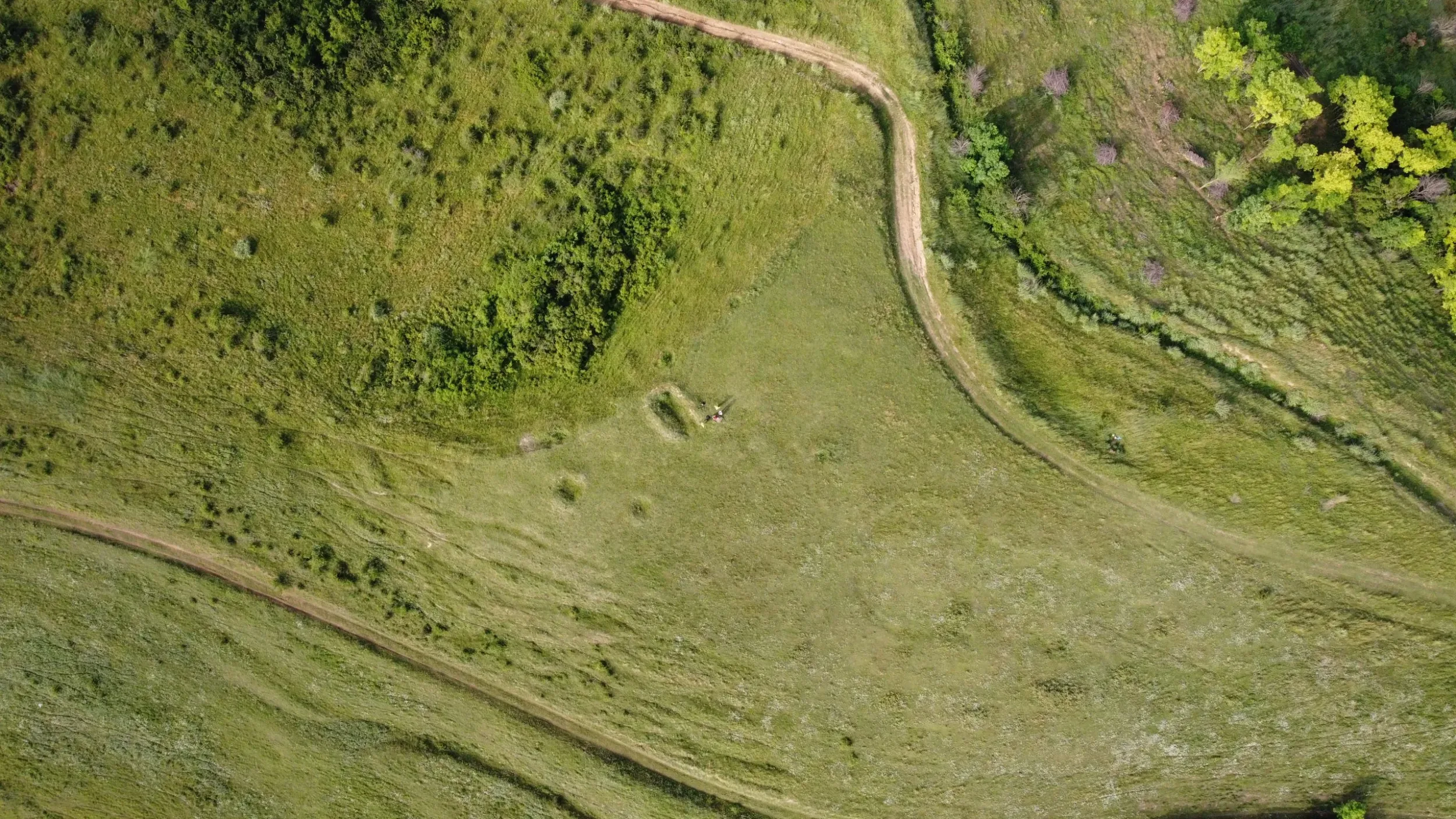
The prototype was first tested in Belgium, using detailed reference data from the Flemish Land Parcel Identification System. The focus was on distinguishing two broad groups of cover crops—grass-like species, such as oats and rye, and leaf-rich or mixed types, including mustard, oilseed crops, and seed blends commonly used by farmers.
To ensure clarity in the results, winter crops already recorded in the HRL-VLCC were deliberately excluded from the analysis. This allowed the team to concentrate on the actual cover crops used in the interim periods between main growing seasons.
Using a time series of NDVI data from Sentinel-2, the team was able to capture key differences in vegetation phenology across the season. Despite the complexity of the task, the prototype achieved a notable overall classification accuracy of 80.7%—a strong indication of its potential.
Results and Insights
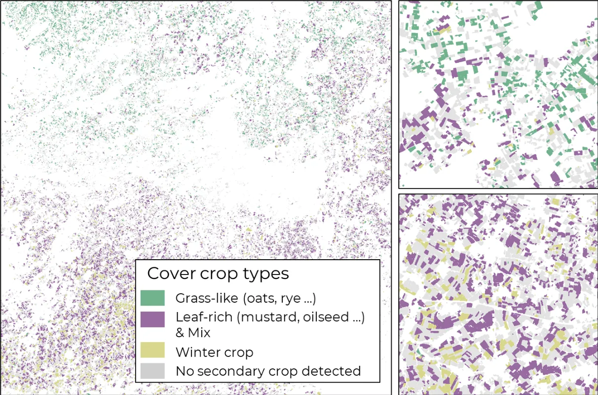
The results were encouraging, especially in showing that the two main cover crop groups could be reasonably well separated using remote sensing data. However, the experience also exposed the challenges of dealing with mixed species in real-world farming. These blends, while beneficial for soil and biodiversity, make it harder to assign a clear spectral signature to any single type.
Additionally, the exercise highlighted an often overlooked but critical issue: the lack of consistent, high-quality reference data. Without a reliable baseline across different regions and crop types, it’s difficult to train and validate models at a broader European scale. Still, the Belgian pilot serves as a proof of concept, offering valuable lessons for scaling up.
Results – prototype demo in Belgium
Why It Matters for Policy and Practice
By enabling detailed, large-scale mapping of cover crop types, the C4 prototype can support:
- Agri-environmental schemes: Monitoring uptake of cover cropping as a sustainable farming practice.
- Soil health assessments: Understanding where cover crops are planted helps assess their contribution to erosion control and nutrient retention.
- CAP compliance and reporting: Automated tools like this could aid Member States in verifying eco-scheme implementation.
With C4, EvoLand is paving the way for more informed, evidence-based soil management at European scale, boosting both the environmental and economic resilience of farming systems.
Newsletter
Stay current! Subscribe to our EvoLand newsletter!