Towards an operational pan-European tree type mapping
26 Aug 2025
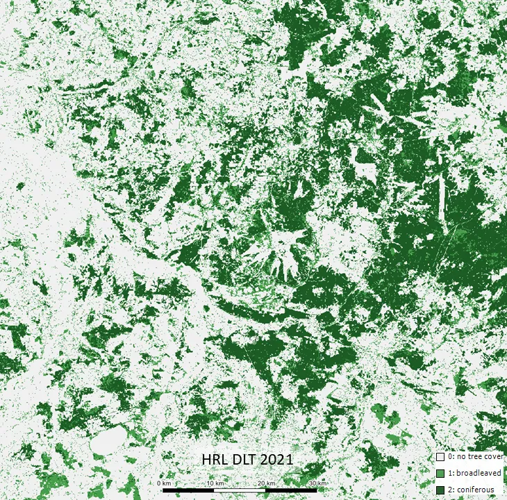
For years, the Copernicus Land Monitoring Service (CLMS) has delivered valuable information through its High-Resolution Layers (HRL) on Tree Cover and Forests. These products include Tree Cover Density and Dominant Leaf Type and have enabled the creation of a Europe-wide Forest Type map which aligns with the widely used FAO definition.
However, more advanced needs—such as mapping tree types across Europe or tracking forest restructuring in detail—remain unmet. EvoLand’s candidate service aims to bridge this gap.
How it works
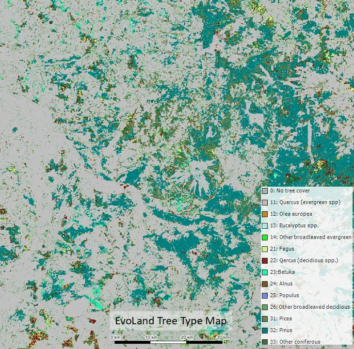
The Tree Type Mapping candidate service is designed to deliver a three-yearly update of tree types across Europe, covering at least 13 different classes to complement the HRL portfolio.
Many countries maintain high-quality National Forest Inventories (NFI), but their precise plot locations are rarely shared due concerns that this might compromise samples which often have a history of several decades. To overcome this, EvoLand’s team gathered, filtered, and harmonised data from multiple sources, including GBIF (Global Biodiversity Information Facility), LUCAS (Land Use/Cover Area frame Survey), Regional inventories and existing national maps and datasets.
The harmonised dataset is used to train a Temporal Convolutional Neural Network (TempCNN) on three years of Sentinel-2 satellite data. The model produces yearly tree type maps, which are then aligned with the HRL Dominant Leaf Type layer.
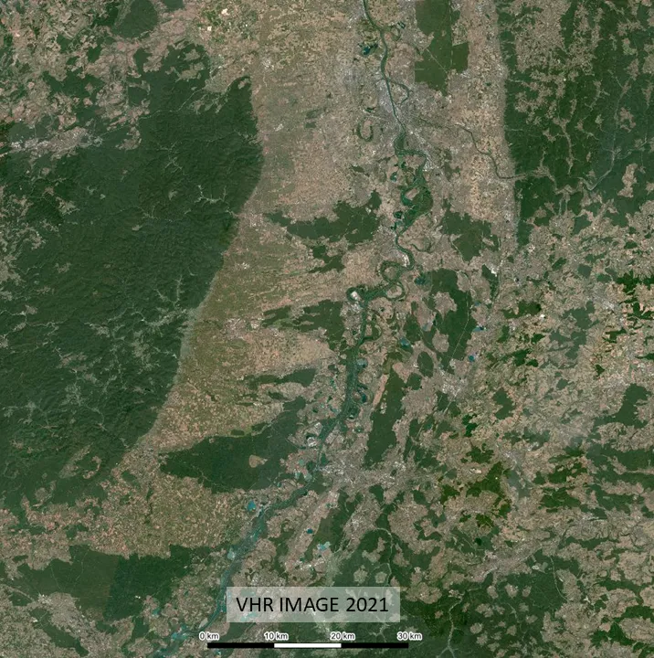
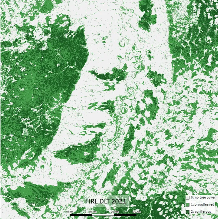
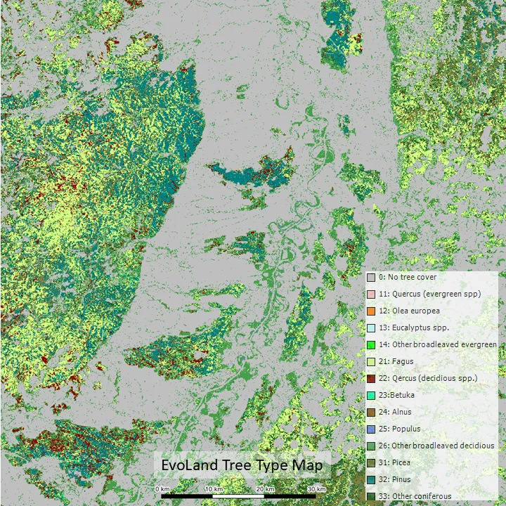
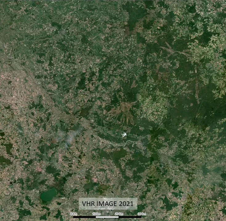
Rhine valley at Speyer, DE
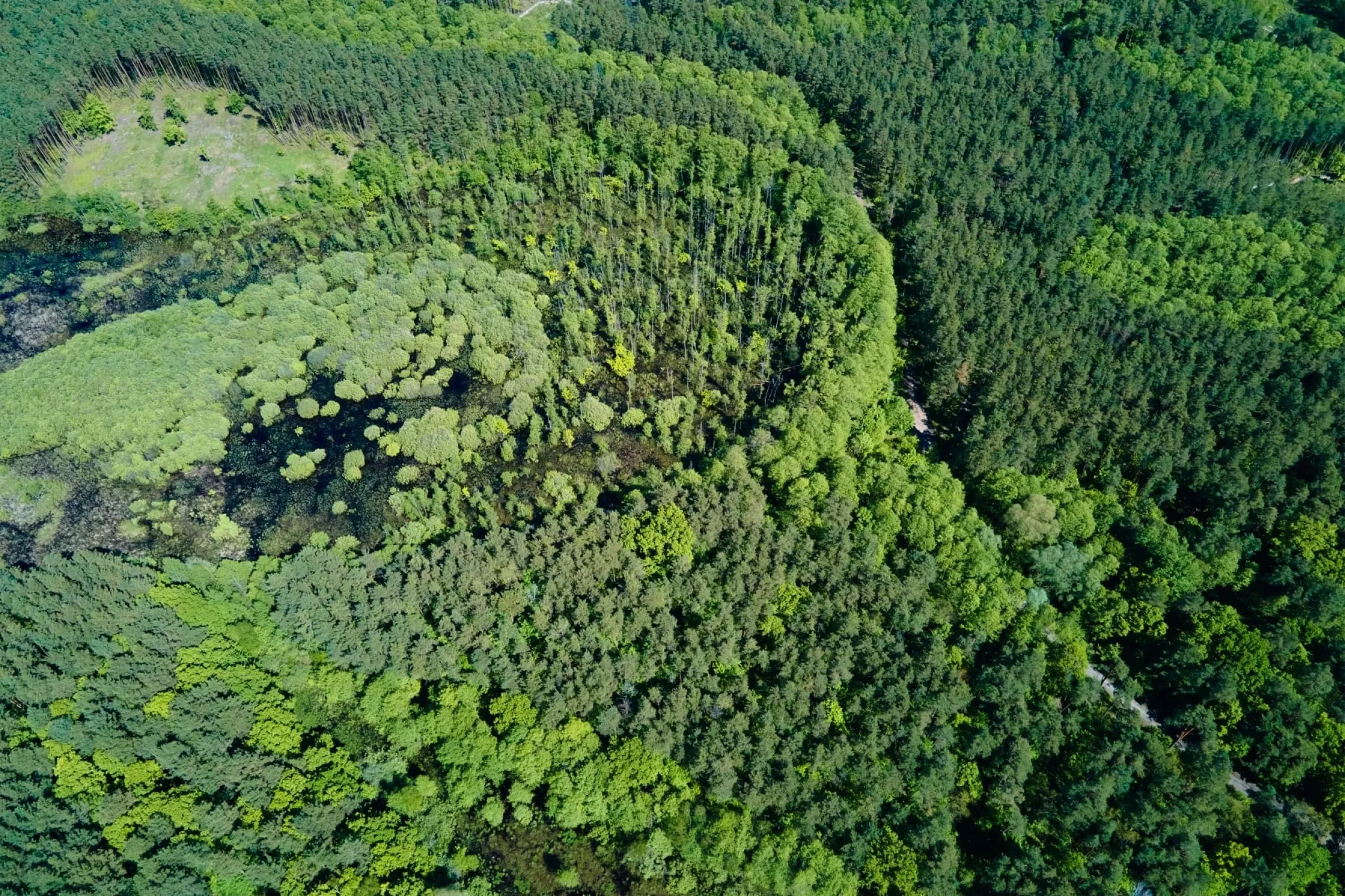
Pine-dominated forests in the Lüneburg Heath, DE
Current results
Independent evaluations suggest this candidate service already achieves an overall accuracy of 76%. The next steps include:
- Refining and expanding training data
- Adding complementary environmental variables (e.g. elevation)
Rolling out mapping for larger European regions
Why it matters
The resulting maps represent more than just technical progress, they are a proof of concept and a benchmark for future forest monitoring. With an operational pan-European Tree Type map, decision-makers will have a powerful new tool to:
- Track forest restructuring in response to climate change
- Support sustainable forest management strategies
- Provide harmonised, high-resolution information for European and national policies
Image Credit:
Newsletter
Stay current! Subscribe to our EvoLand newsletter!