
SpectralEarth-MM: Towards a foundation model for next-generation land cover monitoring across spectra
7 Aug 2025
Foundation models are transforming remote sensing by enabling general-purpose solutions that work across different sensor types and tasks. While RGB, multispectral, and radar domains have seen rapid advances, hyperspectral imagery—with its ability to capture hundreds of spectral bands—remains a largely untapped resource.
SpectralEarth-MM bridges this gap by bringing together:
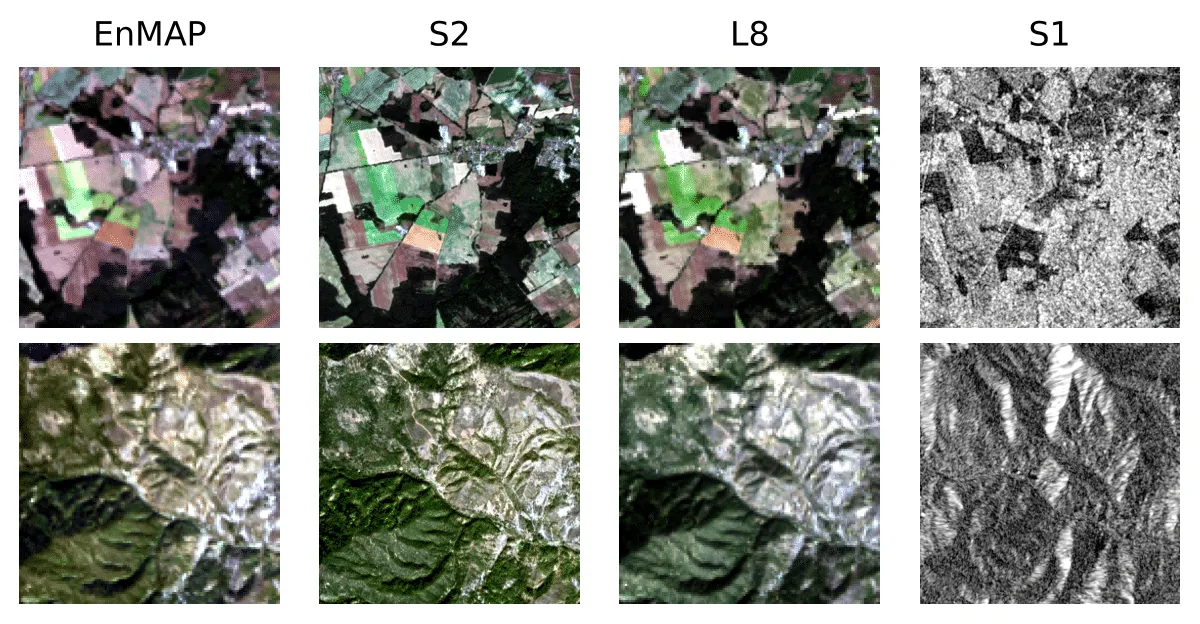
- EnMAP (hyperspectral)
- Sentinel-2 and Landsat-8 (multispectral)
- Sentinel-1 (radar)
While still under development, the resulting model is currently trained on a comprehensive, multi-sensor dataset with a focus on land monitoring downstream applications.
Sample scenes from SpectralEarth-MM showing the same locations across different sensors: EnMAP (hyperspectral), Sentinel-2 and Landsat-8 (multispectral), and Sentinel-1 (radar).
How it works
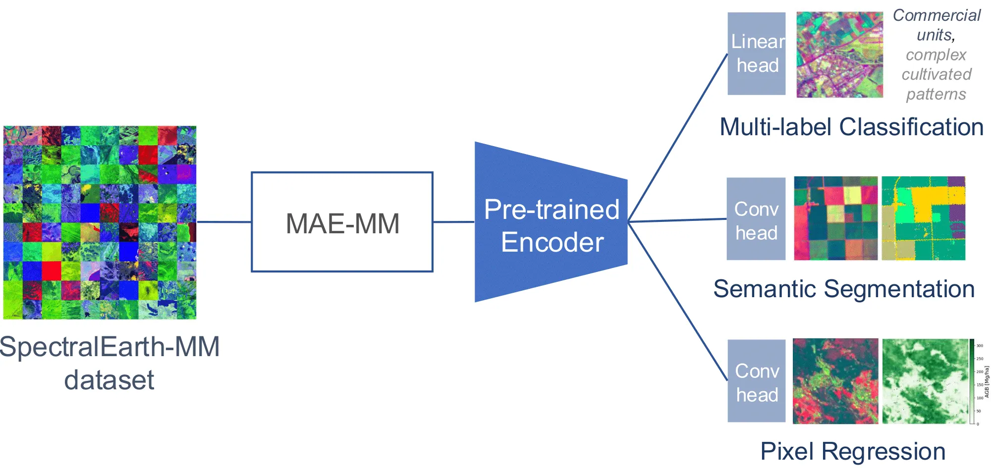
At the heart of SpectralEarth-MM is a vision transformer architecture built for flexibility and scale. Specialized layers are used to handle the unique characteristics of each sensor type. The model is trained with self-supervised techniques to learn unified representations across data sources without requiring exhaustive labelling. This architecture enables the model to handle a wide range of land monitoring tasks with improved performance and adaptability.
The SpectralEarth-MM pipeline: a multi-sensor dataset feeds into a pre-trained encoder, enabling flexible outputs for multi-label classification, semantic segmentation, and pixel-level regression
From Forests to Fields: Key Applications
The capabilities of SpectralEarth-MM are being tested on several critical use cases:
- Forest monitoring: Classifying tree species with higher accuracy using the rich spectral information from hyperspectral data.
- Agriculture: Identifying crop types at scale, supporting precision farming and agri-environmental policies.
- General land cover: Performing both patch-level and pixel-level classification across landscapes for consistent, high-resolution mapping.
Towards a New Era of Land Monitoring
By unifying hyperspectral, multispectral, and radar data in a single benchmark and foundation model, SpectralEarth-MM opens the door to truly multi-sensor, scalable solutions for Copernicus Land Monitoring and beyond. Its ability to support diverse tasks, from forest species mapping to crop classification, makes it a key step towards more general, automated, and accurate Earth observation systems.
The SpectralEarth-MM dataset lays the groundwork for the next generation of land monitoring methods for EvoLand beyond current prototypes—flexible, cross-sensor, and ready to capture the complexity of our changing planet.
SpectralEarth-MM is an ongoing research effort, and our team is currently finalising the details for publication. Stay tuned for more updates as we move closer to sharing the full methodology and results.
Newsletter
Stay current! Subscribe to our EvoLand newsletter!