Weakly supervised learning for Earth observation: Land cover AI models from little to no human input
18 Sep 2025
One critical bottleneck in Earth observation (EO) data science is the need for labelled data. While an increasing fleet of satellites provide hundreds of terabytes in Copernicus EO data each month, training versatile and robust deep learning models typically requires millions of accurately annotated examples. But in practice, drawing boundaries between forests and croplands, or classifying land cover transitions across Europe, is slow, expensive, and sometimes subject to human error. EvoLand has been at the forefront of solving this challenge by turning to weakly supervised and self-supervised learning, enabling distillation of information from unlabeled data.
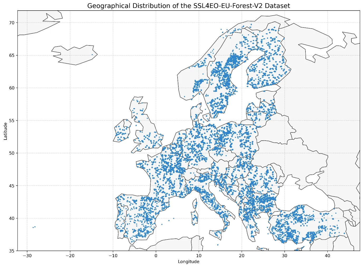
The breakthrough began with the creation of SSL4EO-S12 and its publicly available, open-source updates, a large-scale dataset of over 1 million Sentinel-1 and Sentinel-2 image pairs collected across the entire globe providing one snapshot per season and geolocation. The dataset allows models to learn general representations of landscapes in all conditions before they are fine-tuned for specific tasks. In essence, SSL4EO-S12 provides the “language” of Earth observation: a shared representation of textures, shapes, and spectral patterns that can be reused across multiple applications. In fact, EvoLand extended SSL4EO-S12 to a 108 GB SSL4EO-S12-EU-Forest dataset (cf. Fig. 1) for European applications as relevant to government agencies like the European Environmental Agency (DOI: https://doi.org/10.5281/zenodo.17290776).
Geospatial sampling distribution of the SSL4EO-EU-Forest-V2 dataset as curated and publicly shared by EvoLand.
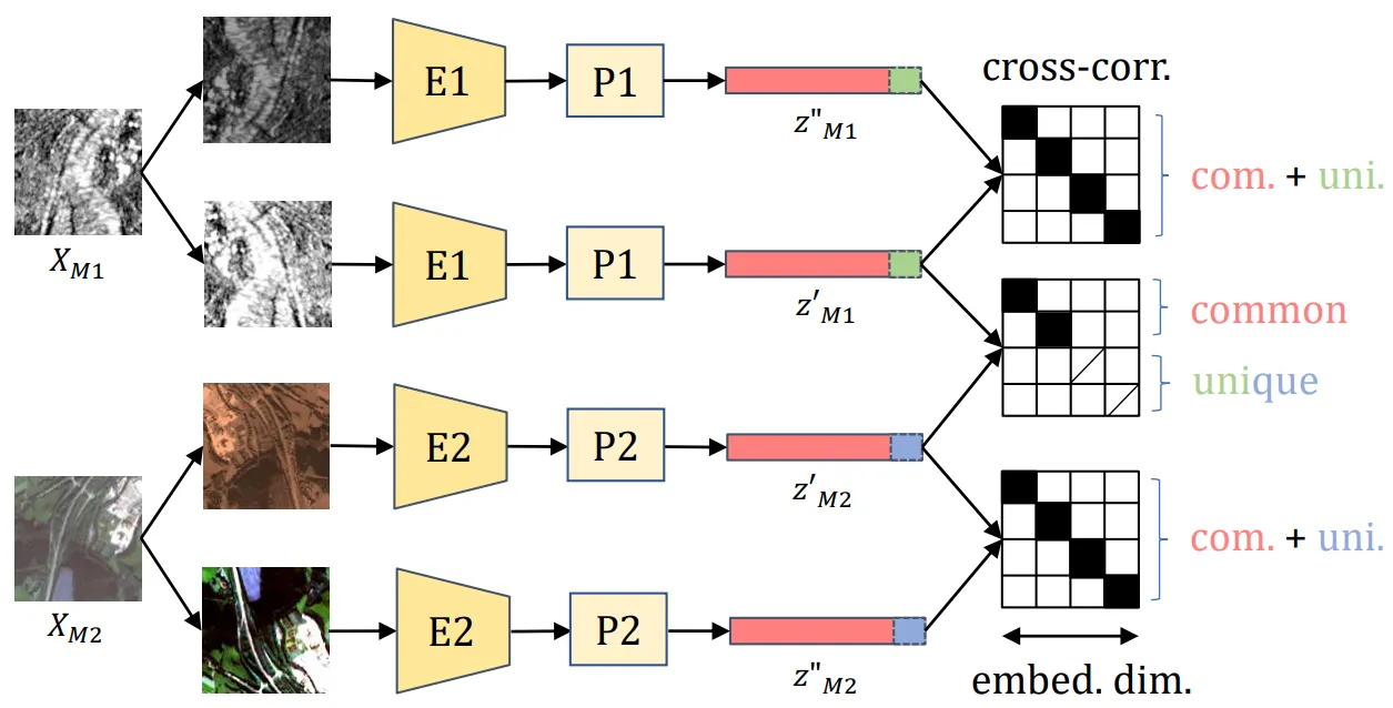
Building on this, EvoLand introduced DeCUR at the 2024 European Conference on Computer Vision – a novel method that learns to align the representations of radar and optical images to distill unique and common features from pairs of radar and optical images of a given EO scene (cf. Fig. 2). This is particularly valuable, because Copernicus Sentinel-1 satellite radar imagery partially penetrate clouds and vegetation, while Sentinel-2 optical imagery captures spectral richness in the visible and infrared. DeCUR’s cross-modal embeddings imply: when optical data are missing due to clouds, radar can fill the gap. At the same time, optical imagery may partially capture information captured by Sentinel-1.
Data fusion workflow of DeCUR: M1 and M2 represent two modalities from which joint embeddings Z are distilled. For EvoLand, Z identifies common (red) and unique (green & blue) features in pairs of spatio-temporally aligned remote sensing imagery for Sentinel-1 (M1) and Sentine-2 (M2).
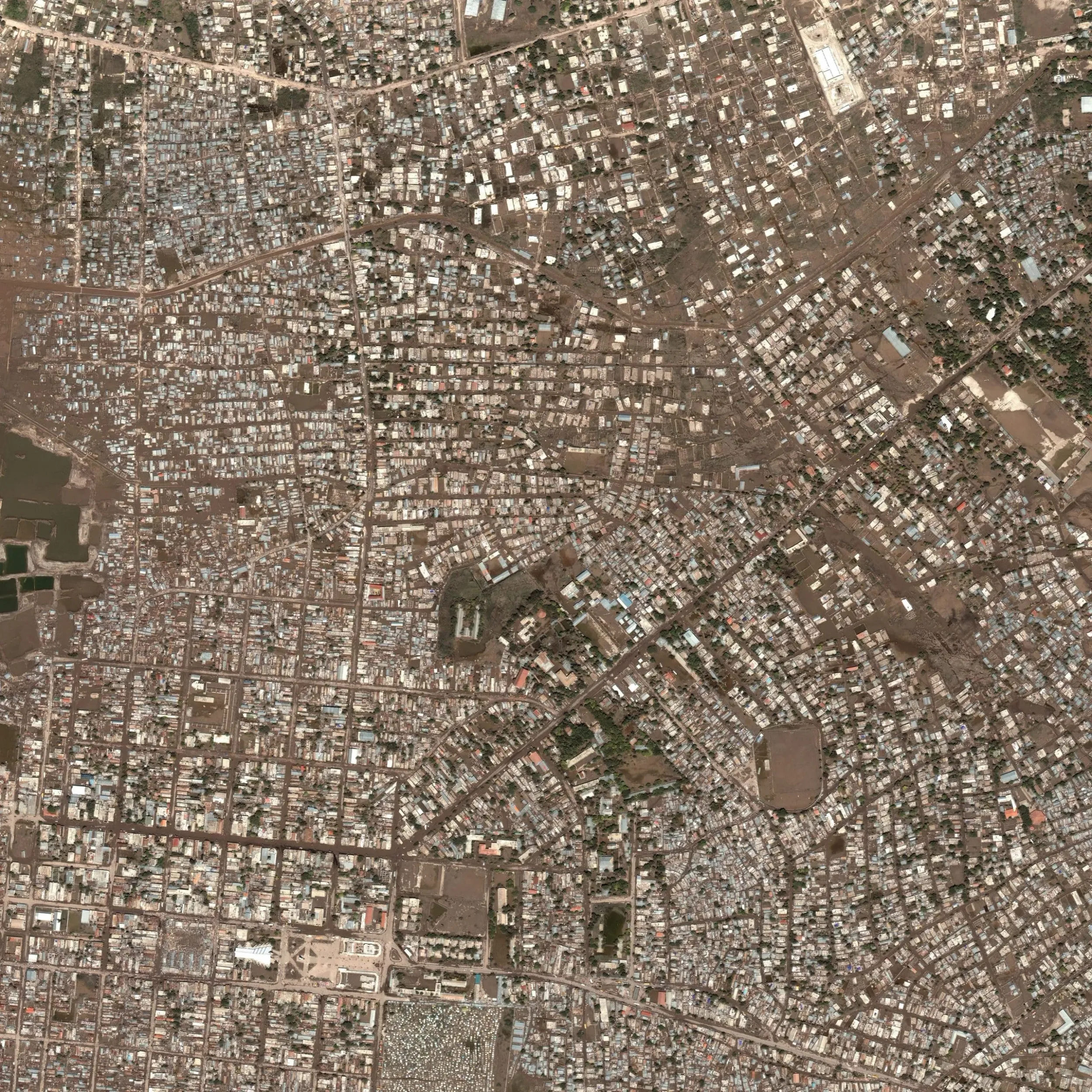
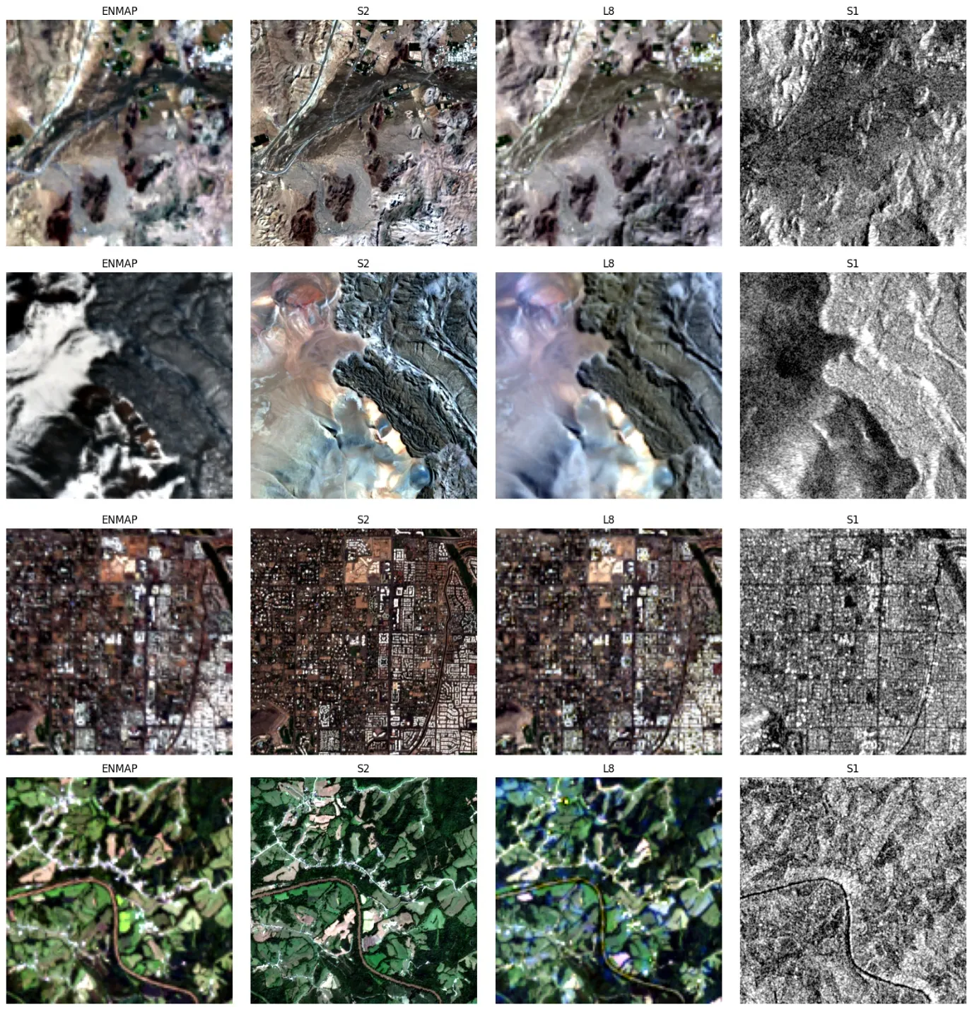
Other advances, such as SoftCon and CromSS, further contributed to state-of-the-art methodologies in weakly supervised learning for EO.: While the former exploits existing land cover maps to guide and improve the training of EO foundation models, the latter deals with training deep learning models on noisy, more easy to come by annotations, for example, to generate land cover maps on the pixel level of EO imagery from low quality human, inexpensive labels Meanwhile, SpectralEarth provides a mature foundation model for hyperspectral data. The model has been trained on the large corpus of German Aerospace’s EnMAP satellite data available for download. Furthers, by transfer learning SpectralEarth prepares for relevant applications on top of future Copernicus missions such as CHIME. By training on spectral cubes rather than simple images, SpectralEarth captures fine-grained details that are crucial for identifying crop types, soil composition, and vegetation stress. And currently, EvoLand pushes an extension of SpectralEarth to SpectralEarth-MM (cf. Fig. 3).
Samples from the SpectralEarth-MM dataset displaying EnMAP, Sentinel-1 & -2, and Landsat-8 images for a given geospatial scene per row.
From careful experiments, the impact of these methods became clear: Weakly supervised learning consistently achieved higher accuracy and better transferability compared to fully supervised baselines – all while requiring far fewer labelled examples. As a consequence, Copernicus AI models can be trained at (continental) scale without prohibitive annotation costs. The methods develop also help to maintina models robust across regions, seasons, and sensors. In turn, those efforts will support Europe’s capacity for scalable and affordable land monitoring. EvoLand’s work demonstrates that the future of EO does not depend on more human labellers, but on smarter ways of learning from the vast oceans of unlabeled data readily available by the Copernicus Programme.
Newsletter
Stay current! Subscribe to our EvoLand newsletter!