
Newsroom
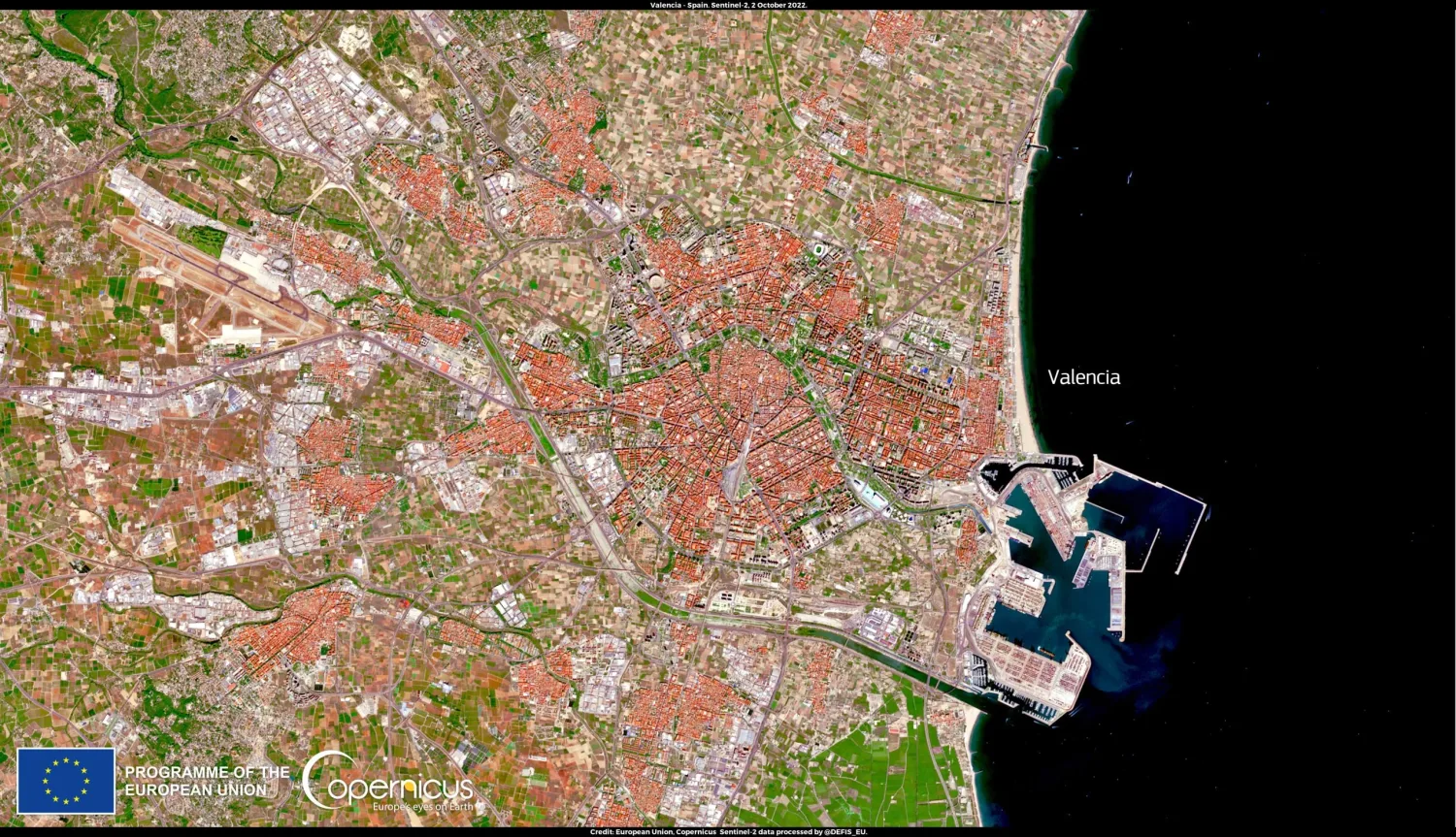 Advancing city planning with impenetrable land monitoring
Advancing city planning with impenetrable land monitoring
Since the turn of the 21st century, dynamic urban changes have been taking place at an unprecedented level. The percentage...
 Enhancing sustainability in agricultural practices through cover crop type mapping
Enhancing sustainability in agricultural practices through cover crop type mapping
Centuries of agricultural and ecological research have led to more effective agricultural methods, such as crop rotation....
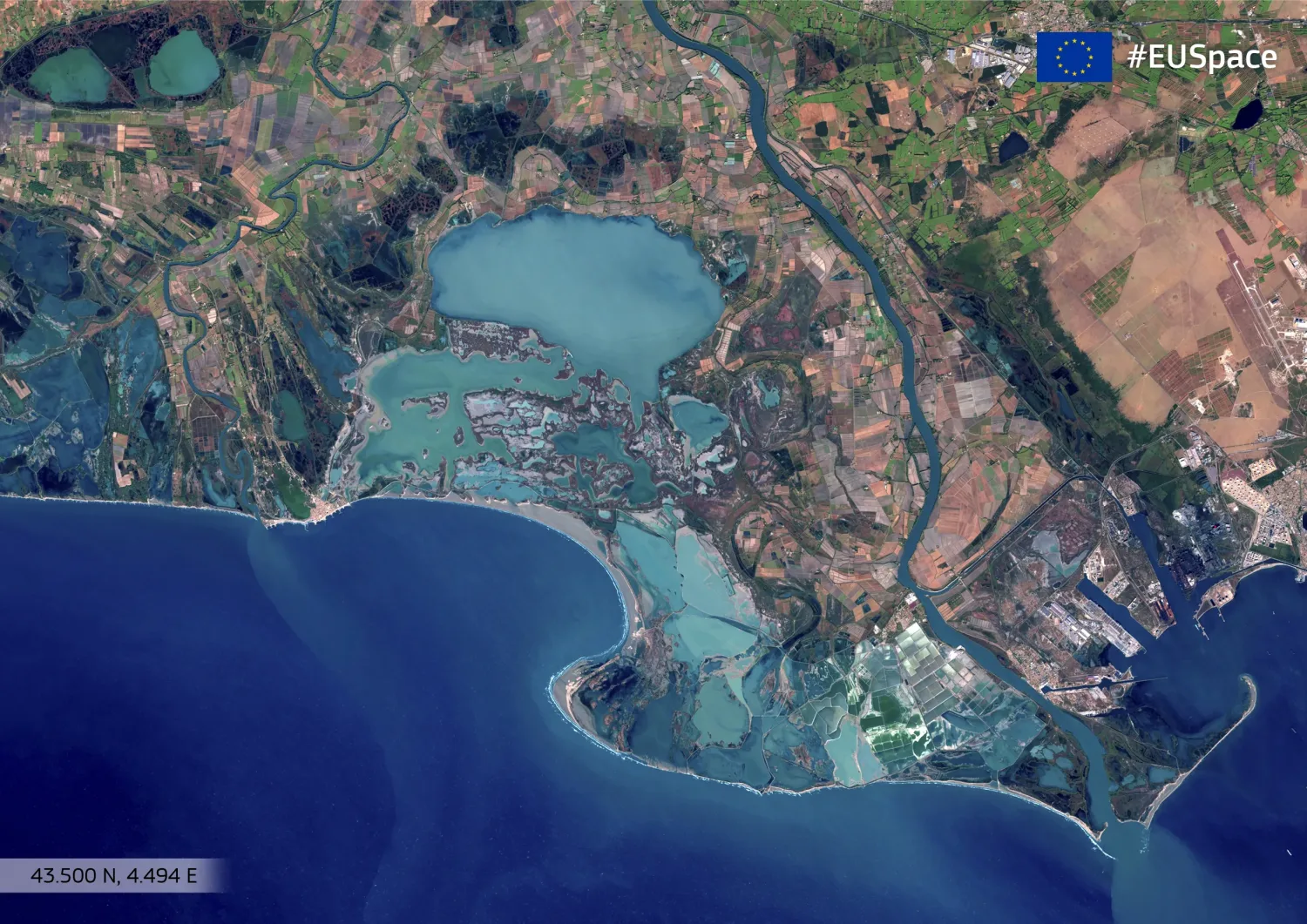 Improving water body mapping by means of novel EO-data and super resolution
Improving water body mapping by means of novel EO-data and super resolution
From the smallest to the largest, water bodies play a crucial role in supporting ecosystems and human communities. Their accurate and constant monitoring becomes essential for understanding changes in freshwater availability, ecosystem health, and climate patterns. Traditionally, water body mapping has relied on various methods, including field surveys and aerial photography. However, these established approaches are known to often have limitations in terms of spatial coverage, resolution, and...
 EvoLand candidate prototype to offer Enhanced Forest Monitoring
EvoLand candidate prototype to offer Enhanced Forest Monitoring
Forests offer a cornucopia of economic, social, and climate-related benefits. For example, they provide habitats and shelter...
 EvoLand sets off to develop new prototype services for the Copernicus Land Monitoring Service
EvoLand sets off to develop new prototype services for the Copernicus Land Monitoring Service
EvoLand is a Horizon Europe project which will develop and test new and innovative methods, algorithms, and eleven candidate...
Multimedia Content
Brochure
Poster
Roll up banner
Scientific poster
EvoLand Brandbook
EvoLand final event banner
EvoLand Results Portal teaser video
Publications
Decoupling Common and Unique Representations for Multimodal Self-supervised Learning
Multilabel-Guided Soft Contrastive Learning for Efficient Earth Observation Pretraining
CromSS: Cross-modal pretraining with noisy labels for remote sensing image segmentation
SpectralEarth: Training Hyperspectral Foundation Models at Scale
Multispectral to Hyperspectral using Pretrained Foundational model
Temporal Attention Multi-Resolution Fusion of Satellite Image Time-Series, applied to Landsat-8 and Sentinel-2: all bands, any time, at best spatial resolution
Revisiting remote sensing cross-sensor Single Image Super-Resolution: the overlooked impact of geometric and radiometric distortion
Press releases
From research to results – EvoLand concludes its three-year journey in land monitoring innovation with an open invitation to all
EvoLand launches its second development phase after a successful mid-project meeting
EvoLand sets off to develop new Copernicus Land Monitoring Service
Newsletter
Stay current! Subscribe to our EvoLand newsletter!